
Exiftool is a simple yet powerful tool to edit exif data from images. In this post we aim to get GPS coordinates from exif from images in all of our sub-directories in order to create a database with all the image data we got up to date.
First of all we download exif tool for windows from exiftool.org , we get the file exiftool(-k).exe and we renaim it to exiftool.exe , then copy and paste in C:/ direcotry
In order to run exiftool we open command line. To do this press window+R and write cmd in the dialog box, then change the directory to C:/ by writing cd C:/
In order to run the script and get the data we want just simply run the following command:
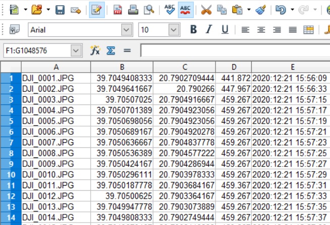
exiftool -r -filename -gpslatitude -gpslongitude -GPSAltitude -createdate -GPSDateStamp -GPSTimeStamp -T -n E:\DRONE > C:\Users\christos\OneDrive\Desktop\out.txtIn our case E:\DRONE folder contains multiple other folders.
the result file looks like:
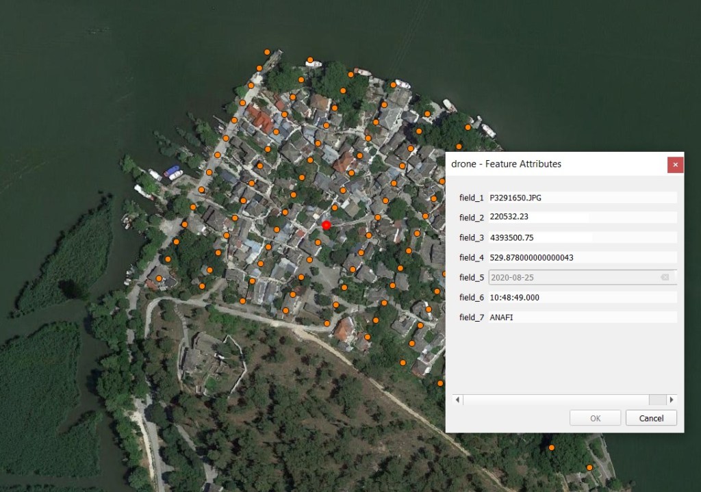
Then we import the extracted GPS coordinates from exif into QGIS to visualize and analyse the data
Another example to get exif data from an RTK drone is to use the next command, this is just for one image, but you can modify the command as above in order to get data for an entire directory with images.
exiftool -gpslatitude -gpslongitude -GPSAltitude -gpsxyaccuracy -gpszaccuracy -pitch -yaw -roll -T -n 0001.JPG