
Drone Mapping and Automated PPK with No Ground Control Points (GCPs): A Real-World Accuracy Assessment
Achieving reliable centimetre-level accuracy in UAV photogrammetry depends on much more than the drone itself. The quality of the GNSS observations, the post-processing workflow, the aerial triangulation, and the methodology used to establish independent check points all contribute to the final result.
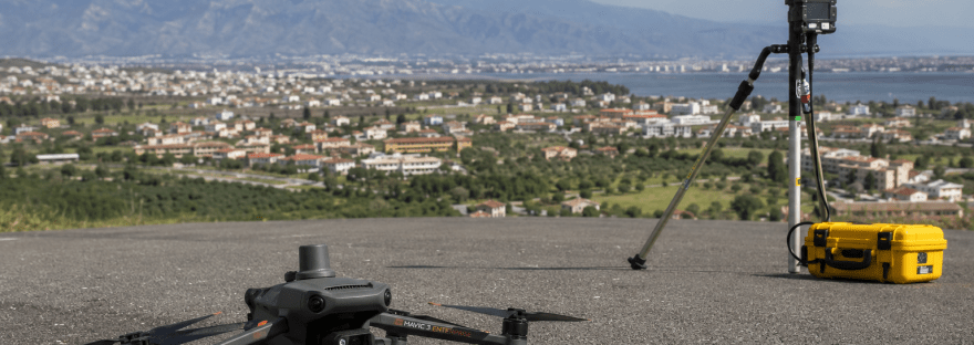
This case study presents a real-world photogrammetric survey performed using a DJI Mavic 3 Enterprise RTK combined with an automated Python + RTKLIB Post-Processed Kinematic (PPK) workflow. The objective was to evaluate the achievable absolute accuracy using a low-cost GNSS base station while validating the results with independently surveyed check points.
The survey covered an elongated area measuring approximately 840 m × 300 m (approximately 25.2 hectares).
Flight Parameters
- UAV: DJI Mavic 3 Enterprise RTK
- Survey Area: 840 m × 300 m
- Flight Height: 70 m Above Ground Level
- Terrain Mode: Follow Terrain
- Flight Speed: 8 m/s
- Flight Lines: 6
- Positioning Method: Post-Processed Kinematic (PPK)
The UAV imagery was processed using camera positions corrected through PPK rather than relying solely on real-time positioning.
Automated PPK Workflow
The complete GNSS processing workflow was automated using a custom-developed Python application built around RTKLIB.
The software automatically:
- imports GNSS observation files,
- prepares the processing environment,
- executes RTKLIB,
- evaluates the quality of the solution,
- exports corrected camera positions ready for photogrammetric processing.
The base station consisted of a u-blox ZED-F9P receiver, demonstrating that high-quality PPK results can be achieved using affordable GNSS hardware when combined with appropriate processing techniques.
Independent Accuracy Verification
To independently assess the accuracy of the final photogrammetric model, four check points were surveyed separately from the aerial triangulation.
Equipment
Base Station
- u-blox ZED-F9P
Rover
- Septentrio mosaic-X
Each checkpoint was occupied for approximately 2–3 minutes and processed using the same automated Python–RTKLIB PPK workflow.
Importantly, these check points were not used as Ground Control Points (GCPs) during bundle adjustment. They served exclusively as independent checkpoints for accuracy assessment.
Aerial Triangulation Performance
The bundle adjustment produced the following image-centre residuals:
| Component | RMS Error |
|---|---|
| X | 0.001 m |
| Y | 0.001 m |
| Z | 0.004 m |
| Total | 0.004 m |
These values indicate excellent internal consistency of the photogrammetric adjustment.
Independent Check Point Results
Measured coordinate residuals:
| Point | ΔX (m) | ΔY (m) | ΔZ (m) |
| 1 | -0.016 | -0.016 | 0.007 |
| 2 | -0.018 | -0.009 | 0.008 |
| 3 | -0.012 | -0.010 | 0.012 |
| 4 | -0.002 | -0.001 | 0.012 |
Calculated Accuracy
| Statistic | Value |
| RMSE X | 0.0135 m |
| RMSE Y | 0.0105 m |
| Horizontal RMSE | 0.0171 m |
| Vertical RMSE | 0.0100 m |
| 3D RMSE | 0.0198 m |
The achieved accuracy demonstrates:
- Horizontal accuracy: approximately 1.7 cm
- Vertical accuracy: approximately 1.0 cm
- Overall 3D accuracy: approximately 2.0 cm
These results were achieved without using the check points to constrain the bundle adjustment, providing an unbiased evaluation of the final model.
Observations
One interesting observation concerns the design of the ground targets used for the independent check points.
For this project, each checkpoint was marked with a red spray-painted circle approximately 12 cm in diameter on asphalt. These targets were clearly visible in the aerial imagery and proved adequate for identifying the checkpoint locations during photogrammetric processing.
However, unlike professional photogrammetric targets, a painted circle does not provide a precisely defined geometric centre. The exact centre must be estimated manually during image measurement, introducing a small degree of operator interpretation. This can contribute to minor variations in the measured image coordinates.
For future surveys, black-and-white checkerboard targets or coded photogrammetric targets printed on rigid material would likely improve measurement repeatability. Their high contrast and well-defined geometry make it easier to identify the exact centre with greater consistency across multiple images.
Although it cannot be stated conclusively that such targets would have improved the final accuracy in this specific project, they would be expected to reduce image measurement uncertainty and potentially produce slightly lower checkpoint residuals. The overall accuracy would still depend on additional factors, including image quality, Ground Sampling Distance (GSD), camera calibration, GNSS solution quality, and the strength of the photogrammetric network.
Conclusions
This study demonstrates that centimetre-level mapping accuracy can be achieved using a relatively compact and cost-effective surveying workflow.
By combining:
- DJI Mavic 3 Enterprise RTK,
- a u-blox ZED-F9P base station,
- independently surveyed Septentrio mosaic-X check points,
- automated Python processing,
- RTKLIB PPK computation,
- and rigorous accuracy verification,
the project achieved an independent accuracy of approximately 1.7 cm horizontally and 1.0 cm vertically over a 25-hectare survey area.
The results highlight that careful workflow design, robust GNSS processing, and independent validation are often more important than relying solely on onboard RTK positioning. They also demonstrate that open-source processing tools such as RTKLIB, when integrated into an automated workflow, can deliver professional-grade results suitable for engineering, surveying, cadastral, and infrastructure mapping applications.
As UAV technology and GNSS processing continue to evolve, automated PPK workflows provide an increasingly efficient and reliable approach for producing highly accurate geospatial data while reducing field time and operational costs.


